
- North America
- Canada
- Quebec
- Pic Longview
-
 Search
Traveling Luck for Pic Longview Quebec, Canada 
 Explore around
Pic Longview?
Explore around
Pic Longview? Wikipedia near Pic Longview
 Where to stay near Pic Longview
The timezone in Pic Longview is America/Pangnirtung
Morning Sunrise at 03:53 and Evening Sunset at 20:08. It's Dark
Rough GPS position Latitude. 50.5835°, Longitude. -75.6993°
Morning Sunrise at 03:53 and Evening Sunset at 20:08. It's Dark
Rough GPS position Latitude. 50.5835°, Longitude. -75.6993°
Weather near Pic Longview Last report from Nemiscau Airport Supplementary Aviation Weather Reporting Station , 65.9km away
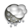 light shower(s) snow drizzle snow Temperature: -1°C / 30°F
Wind: 18.4km/h West
Cloud: Solid Overcast at 1100ft
Satellite map of Pic Longview and it's surroudings...
Geographic features & Photographs around Pic Longview in Quebec, Canada
lake a large inland body of standing water.
- Lac Boissy (16km)
- Lac Kapisicoca (16.8km)
- Lac Sirmac (18.3km)
- Lac des Sphaignes (18.6km)
- Lac Lafargue (19.1km)
- Lac Dalogny (20km)
- Lac Morain (21.5km)
- Lac La Chevardière (22.6km)
- Lac Thiballier (22.6km)
- Lac Clapier (24.6km)
- Lac Clinchamp (27km)
- Lac Triart (27.8km)
- Lac Trépezet (29.2km)
- Lac Capichigamau (29.6km)
- Lac Saint-Poncy (29.8km)
- Lac Caminscanane (30.2km)
- Lac de la Bétulaie (30.9km)
- Lac Hobier (30.9km)
- Lac des Diorites (31.1km)
- Lac Mineray (32.1km)
- Lac Savournin (33.3km)
- Lac Moquachéa (33.6km)
- Lac Perkins (34.1km)
- Lac Sauniot (34.5km)
- Lac Gariteau (35.8km)
- Lac Assinica (36km)
- Lac Deriares (36.2km)
- Lac La Fare (36.8km)
- Lac La Milletière (37km)
- Lac Ginguet (37.5km)
- Lac de la Bruine (38.4km)
- Lac Perdu (38.6km)
- Lac Labeau (41.3km)
- Lac Du Guerny (41.6km)
- Lac Amisquioumisca (43.6km)
- Lac Jacquin (45.7km)
- Lac Depiace (47.3km)
- Lac Harnois (48km)
area a tract of land without homogeneous character or boundaries.
stream a body of running water moving to a lower level in a channel on land.
- Ruisseau Lucky Strike (8.3km)
- Rivière Assinica (20.4km)
- Rivière Coigne (22.7km)
reserve a tract of public land reserved for future use or restricted as to use.
- Réserve faunique Assinica (37.3km)
administrative division an administrative division of a country, undifferentiated as to administrative level.
- Circonscription électorale d'Ungava (23.3km)
mountain an elevation standing high above the surrounding area with small summit area, steep slopes and local relief of 300m or more.
- Pic Longview (0km)
hill a rounded elevation of limited extent rising above the surrounding land with local relief of less than 300m.
- Colline Lookout (37.1km)
 Wikipedia entries close to Pic Longview
- Oujé-Bougoumou, Quebec
- Chapais, Quebec city o city
- Nemaska, Quebec
- Waswanipi, Quebec
- Nemiscau, Quebec
- Chibougamau, Quebec city o
- Chibougamau/Chapais Airport airport airport
- Nemiscau Airport airport airport
- Soscumica Lake waterbody waterbody
- Mistissini Water Aerodrome airport airport
- Miquelon (hameau)
- Mistassinisee lake waterbody
- Matagami, Quebec city o city
- Matagami Water Aerodrome airport airport
- Simijacá city o
- Matagami Airport airport airport