
- North America
- Canada
- Nunavut
- Wigle Islands
-
 Search
Traveling Luck for Wigle Islands Nunavut, Canada 
 Explore around
Wigle Islands?
Explore around
Wigle Islands? Wikipedia near Wigle Islands
 Where to stay near Wigle Islands
The timezone in Wigle Islands is America/Danmarkshavn
Morning Sunrise at 06:17 and Evening Sunset at 02:48. It's Dark
Rough GPS position Latitude. 63.5673°, Longitude. -68.1645°
Morning Sunrise at 06:17 and Evening Sunset at 02:48. It's Dark
Rough GPS position Latitude. 63.5673°, Longitude. -68.1645°
Weather near Wigle Islands Last report from Iqaluit, N. W. T., 30km away
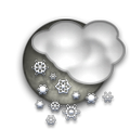 light snow Temperature: 1°C / 34°F
Wind: 3.5km/h South/Southeast
Cloud: Few at 1000ft Broken at 1500ft Broken at 4000ft Broken at 8700ft
Satellite map of Wigle Islands and it's surroudings...
Geographic features & Photographs around Wigle Islands in Nunavut, Canada
island a tract of land, smaller than a continent, surrounded by water at high water.
- Sybil Island (1.7km)
- Crimmins Island (2.1km)
- Jenvey Island (2.1km)
- Pichit Island (3.5km)
- Kudlago Island (4.7km)
- Sale Island (7.8km)
- Frobisher's Farthest (11km)
- Pink Lady Island (14.1km)
- Algerine Island (15.1km)
- Coffin Island (15.9km)
- McBride Island (15.9km)
- Alligator Island (16.3km)
- Mair Island (17.5km)
- Gardiner Island (18.3km)
- Mitchell Island (18.8km)
- Cairn Island (18.8km)
- Ptarmigan Island (19.5km)
- Thompson Island (20.3km)
- Aubrey Island (20.7km)
- Pan Island (21.5km)
- Low Island (21.7km)
- McLaren Island (21.9km)
- McAllister Island (22.1km)
- Emerick Island (22.5km)
reef(s) a surface-navigation hazard composed of consolidated material.
- O'Connell Reef (3.5km)
- Quinn Reef (4km)
- Laprade Reef (7.8km)
- Johnston Reef (10.5km)
- Palmer Reef (11.2km)
- Deception Reef (15.9km)
- Charybdis Reef (18.7km)
- Shagstone Reef (19km)
- Scylla Reef (20km)
shoals hazards to surface navigation composed of unconsolidated material.
- Folly Reefs (8.5km)
- Remus Rock (12.6km)
- Romulus Rock (13.8km)
- Alligators Teeth (15.3km)
- Nipper Rock (16.2km)
- Theron Reefs (18.6km)
channel the deepest part of a stream, bay, lagoon, or strait, through which the main current flows.
- Mandarin Passage (8.7km)
- Deep Passage (14.1km)
- Algerine Passage (18.3km)
- Bartlett Narrows (20km)
- Cornelia Channel (21.8km)
Accommodation around Wigle Islands
NAVIGATOR INN 1036 RING ROAD, Iqaluit
FROBISHER INN RINGROAD, Iqaluit
point a tapering piece of land projecting into a body of water, less prominent than a cape.
- Koodloo Point (8.7km)
- Miner Point (8.8km)
- Lamb Point (13.6km)
peninsula an elongate area of land projecting into a body of water and nearly surrounded by water.
- Pichit Peninsula (4.7km)
- Laird Peninsula (14.6km)
- Becher Peninsula (17.5km)
bay a coastal indentation between two capes or headlands, larger than a cove but smaller than a gulf.
inlet a narrow waterway extending into the land, or connecting a bay or lagoon with a larger body of water.
- Porter Inlet (1.9km)
- Tarr Inlet (21.3km)
islands tracts of land, smaller than a continent, surrounded by water at high water.
- Wigle Islands (0km)
- Old Squaw Islands (14.5km)
ledge a rocky projection or outcrop, commonly linear and near shore.
- Peter Ledge (18.9km)
hill a rounded elevation of limited extent rising above the surrounding land with local relief of less than 300m.
- Churchill's Thumb (16.3km)
cape a land area, more prominent than a point, projecting into the sea and marking a notable change in coastal direction.
- Cape Rammelsberg (19.3km)
 Wikipedia entries close to Wigle Islands
- Inuksuk High School city o city
- Legislative Assembly of Nunavut city o city
- Iqaluit city k city
- Iqaluit Airport airport airport
- Soper River river
- Frobisher-Bucht bay waterbody
- Kimmirut Airport airport airport
- Big Island, Nunavut isle
- Amadjuak-See lake waterbody
- Hudsonstraße strait waterbody