Traveling Luck for Oued Moulouya Oriental, Morocco 
Alternatively known as Rio Mullya, Rio Muluya, Uad Muluya
The timezone in Oued Moulouya is Africa/Casablanca
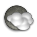
Morning Sunrise at 04:57 and Evening Sunset at 19:15. It's Dark
Rough GPS position Latitude. 35.1200°, Longitude. -2.3300°
Morning Sunrise at 04:57 and Evening Sunset at 19:15. It's Dark
Rough GPS position Latitude. 35.1200°, Longitude. -2.3300°
Weather near Oued Moulouya Last report from Oujda, 66.1km away
 Temperature: 18°C / 64°F
Wind: 15km/h North
Cloud: Few at 500ft Few Cumulonimbus at 3300ft Broken at 10000ft
Satellite map of Oued Moulouya and it's surroudings...
Geographic features & Photographs around Oued Moulouya in Oriental, Morocco
populated place a city, town, village, or other agglomeration of buildings where people live and work.
- Charaba (2.8km)
- Mechra Keïloul (6.6km)
- El Msaada (8.4km)
- Abd el Kader Sadia (9.3km)
- El Borj (10.4km)
- Saïdia (11.2km)
- Tarourt Lalla Soueka (11.6km)
- Gaams (12.5km)
- Marsa Ben Mehidi (12.8km)
- Tazagouin (15.2km)
- Oulad Mansour (15.6km)
- Madagh (16.8km)
- Hamri (16.9km)
- Attamna (17.1km)
- Khodrane (17.4km)
- Mehdia (17.4km)
- Marsa Ben Mehidi (17.6km)

- Mahdia (17.9km)
- Oulad Zenati (18.8km)
- Adjeroud (19.5km)

- Ijertsal (19.7km)
- Beni Oukil (20.7km)
- Merrika (21.2km)

- Douar Chaïb Rasso (22km)

shrine a structure or place memorializing a person or religious concept.
- Sidi Ikhlef (8.4km)
- Sidi Abdallah (8.5km)
- Sidi Mohammed Ameziane (10.8km)
- Sidi Moulay Bagdad (16.2km)
- Sidi Bel Hassene (17.2km)
- Sidi Salah (18.9km)
- Sidi Mohand (19.2km)
- Sidi Brahim (21.4km)
island a tract of land, smaller than a continent, surrounded by water at high water.
- Isla del Rey (13.3km)

- Isla del Congreso (14.8km)

- Isla de Isabel II (14.8km)

tribal area a tract of land used by nomadic or other tribes.
- Oulad Mansour (10.2km)
- Oulad el Haj Kebdana (11.4km)
- Triffa (13.8km)
Accommodation around Oued Moulouya
Iberostar Saidia Hotel Med Azur S.A. BP 331, Saidia
Be Live Grand Saidia Parcela H7, Saidia
Oriental Bay Beach Golf & Spa Zone Touristique, Saidia
area a tract of land without homogeneous character or boundaries.
- Oulad Youssef El Kbir (13.9km)
- Oulad El Haj (16km)
- Bou Assem (21.3km)
mountain an elevation standing high above the surrounding area with small summit area, steep slopes and local relief of 300m or more.
- Koudiat Tougount (19.8km)
- Djebel Tamerchelt (20.2km)

cape a land area, more prominent than a point, projecting into the sea and marking a notable change in coastal direction.
- Ras Kebdana (10.7km)
- Cap Milonia (20.9km)

stream a body of running water moving to a lower level in a channel on land.
- Oued Moulouya (0km)
- Oued Kiss (14.9km)
spring(s) a place where ground water flows naturally out of the ground.
- Aïn ech Chebbak (6.1km)
- Aïn el Malah (10.2km)
plain(s) an extensive area of comparatively level to gently undulating land, lacking surface irregularities, and usually adjacent to a higher area.
- Sareg (6.4km)
- Plaine des Triffa (19.6km)
mosque a building for public Islamic worship.
- Sidi Mokhtar Boutchich (15.6km)
- Sidi Brahim (18.7km)
administrative division an administrative division of a country, undifferentiated as to administrative level.
- Commune de Marsa Ben Mehidi (17.6km)

stream mouth(s) a place where a stream discharges into a lagoon, lake, or the sea.
- Foum el Kiss (15.2km)
tomb(s) a structure for interring bodies.
- Sidi Moulay Ahmed (17.8km)
hill a rounded elevation of limited extent rising above the surrounding land with local relief of less than 300m.
- El Mokta (22km)

hills rounded elevations of limited extent rising above the surrounding land with local relief of less than 300m.
- Tizza (19.5km)

ravine(s) a small, narrow, deep, steep-sided stream channel, smaller than a gorge.
- Chaïb er Rasso (17.6km)

fort a defensive structure or earthworks.
- Bordj d' Adjeroud (17.9km)

islands tracts of land, smaller than a continent, surrounded by water at high water.
- Islas Chafarinas (14.8km)

 Wikipedia entries close to Oued Moulouya
- Moulouya River river
- Ras Kebdana city o
- Islas Chafarinas isle isle
- Berkane city f city
- Angads Airport airport airport
- Nador city e city
- Nedroma city o
- Beni Ansar city h city
- Melilla city g city
- Oujda city d city
- Maghnia city o
- Flughafen Nador airport airport
- Jerada city o
- Tlemcen city e city
- Alborán isle isle
- Peñón de Alhucemas isle isle
Airports close to Oued Moulouya
Angads(OUD), Oujda, Morocco (66.1km)Melilla(MLN), Melilla, Spanish north africa (75.2km)
Zenata(TLM), Tlemcen, Algeria (102.3km)
Cherif el idrissi(AHU), Al hociema, Morocco (173.6km)
Es senia(ORN), Oran, Algeria (207.7km)
Airfields or small strips close to Oued Moulouya
Taouima, Nador, Morocco (68km)Bou sfer, Bou sfer, Algeria (194.2km)
Sidi bel abbes, Sidi bel abbes, Algeria (199.7km)

 Search
 Explore around
Oued Moulouya?
 Wikipedia near Oued Moulouya
 Where to stay near Oued Moulouya

